-
-
-
-
-
-
2019 Weed Mapping
-
-
-
-
-
If you have any questions or need to contact Ontario County to request weed harvesting or weed fragment pickup, contact information can be found at: Ontario County Macrophyte Program
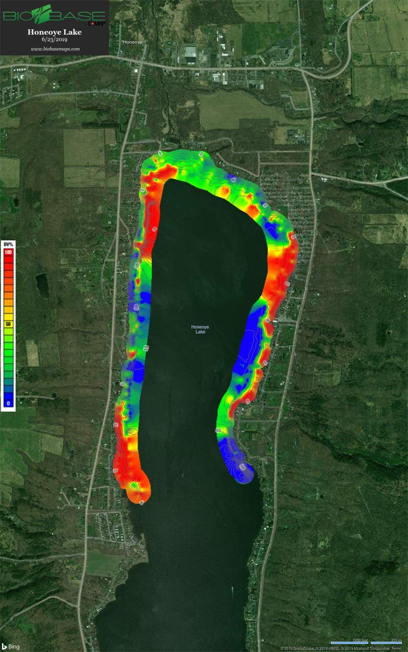
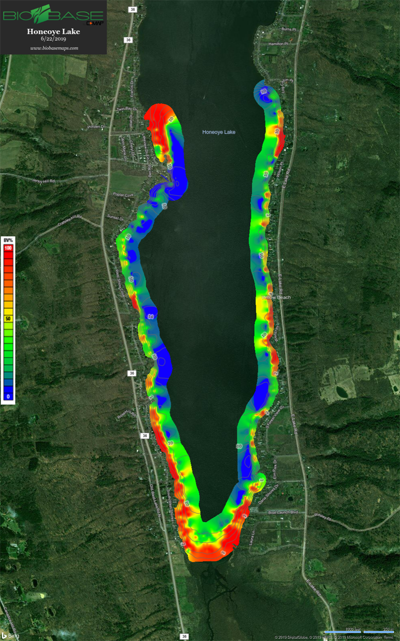
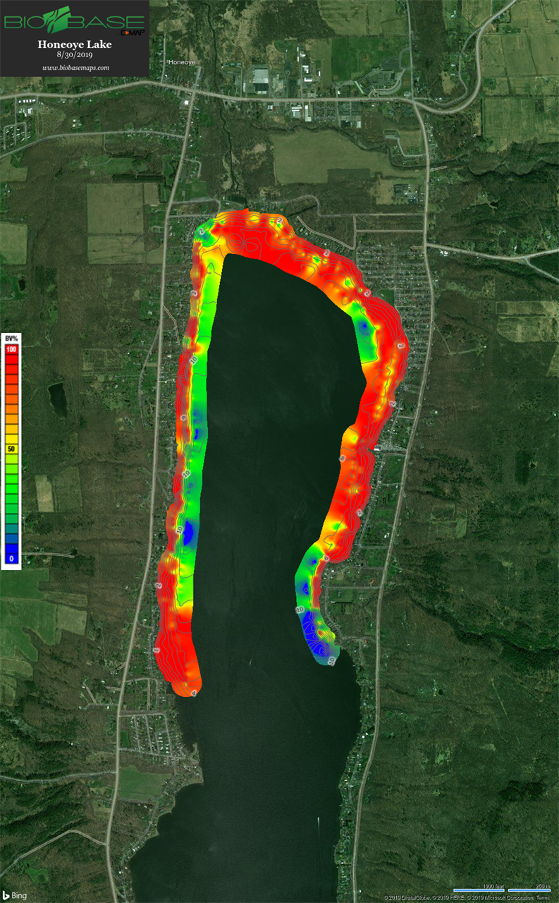
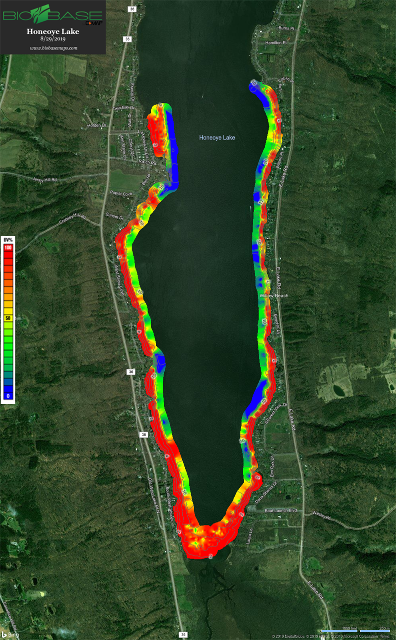
Attached are macrophyte maps of the Honeoye Lake Northern and Southern
basins for your use in understanding where macrophytes are currently being found in the lake
The color code key is on the left hand side on the maps. The colors
represent how much of the water column the vegetation is occupying in %.
For example; red means that the vegetation at that location is occupying
90-100% of the water column. In red areas you can usually see the top of
the vegetation.
Red ~90-100%
Yellow/Orange ~50-90%
Green ~15-50%
Blue ~ 0-15%
There are grey contour depth lines every 2' on the maps. Most of the red
areas on the map are between 5-10' of water depth. The weed line (green to
blue transition) still appears to be at ~12' of water depth.
2019 August Weed Mapping
2019 June Mapping
Our macrophyte visual observations are:
1. The macrophytes are unusually high at some locations in the water column
for this early in the season. There are places like SW Shores, Lakes End
Lane, Pickett's Cove, Cottage Cove, Deyo Drive, Blue Heron Lane, Honeoye
Lake Park, Twin Bay, and Francis Shores where the macrophytes are to the
surface and so heavy we can't easily get our boat into these areas.
Just a reminder that the weed harvesting program starts on Monday June
24th. Please contact Betsy Landre to request your near shore area be
harvested ASAP.