-
-
-
-
-
-
2015 Weed Mapping
-
-
-
-
-
To view any of the previous year harvesting reports, click on the following link to go to the Ontario County Website:
Historical Weed Harvesting Reports
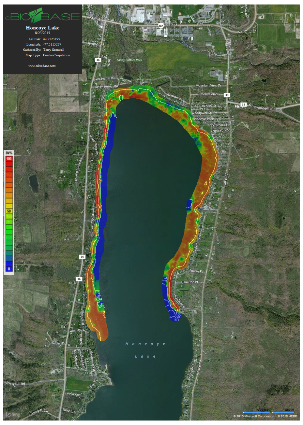
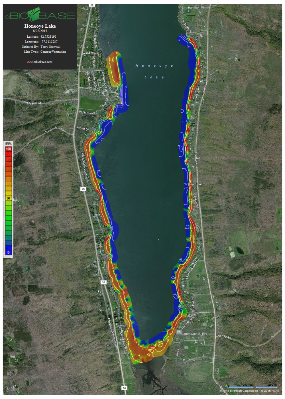
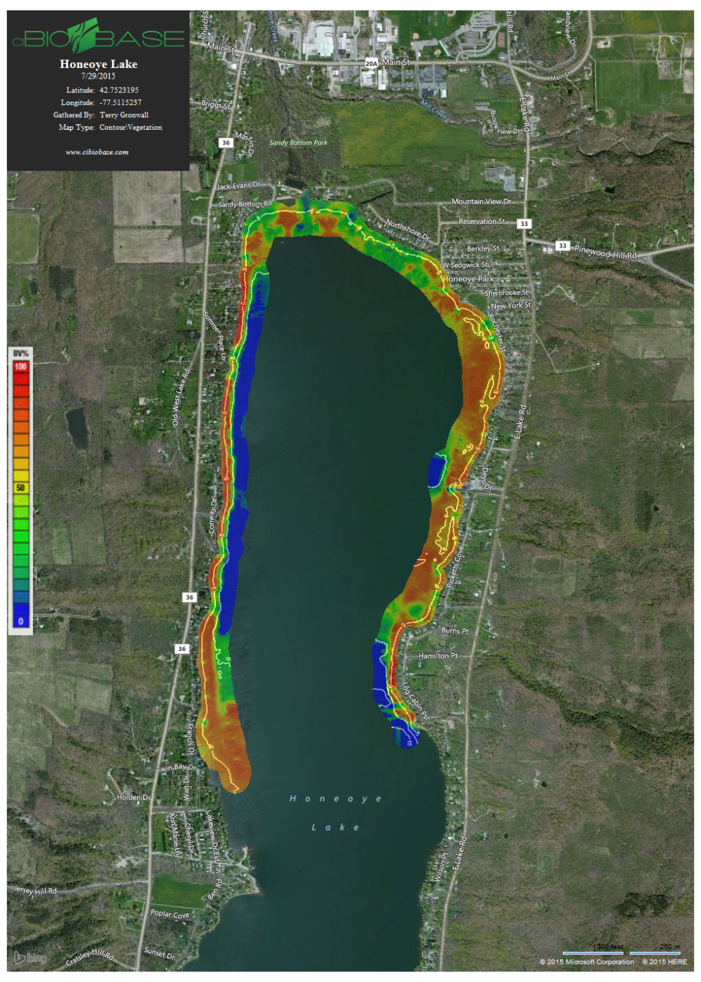
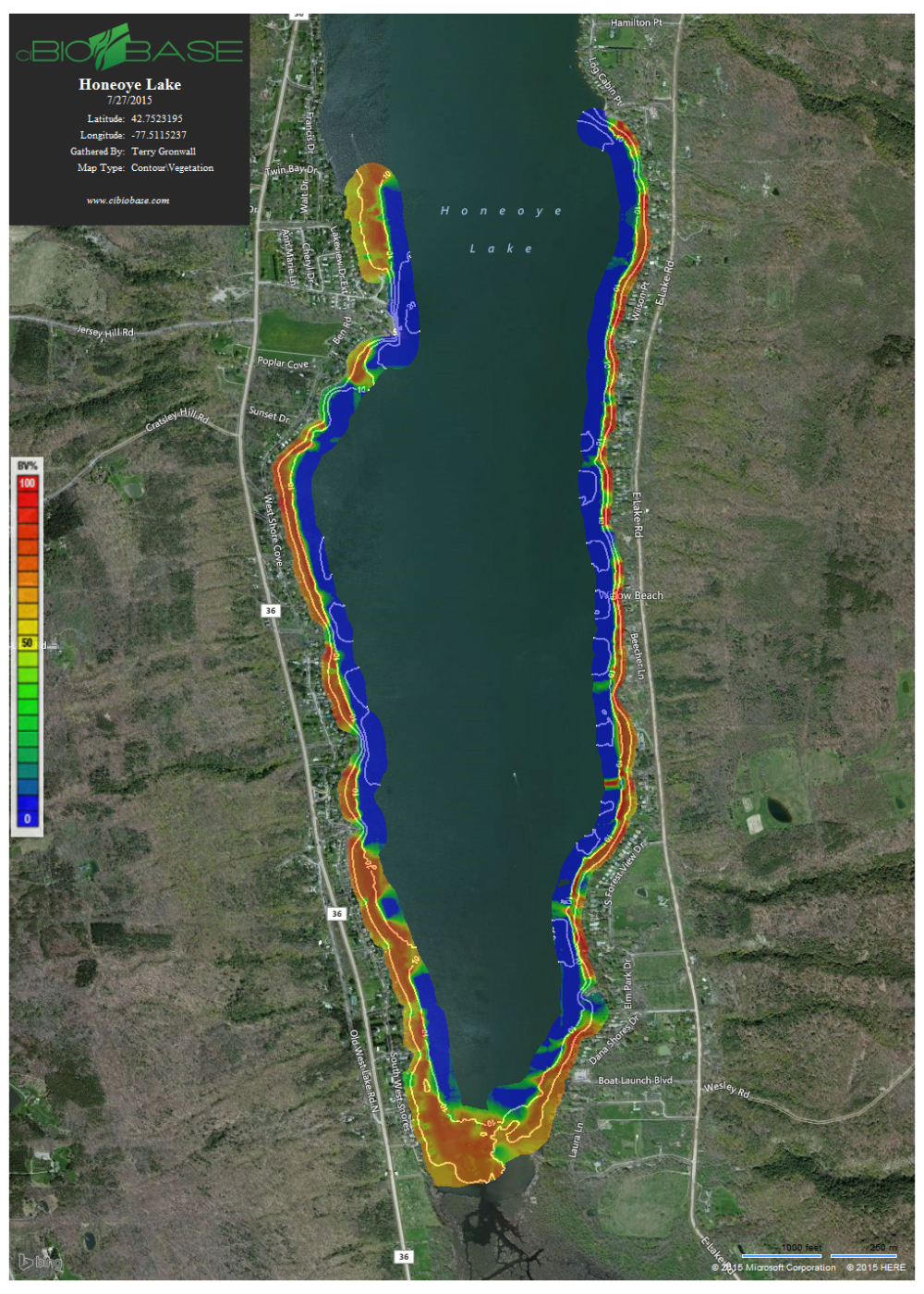
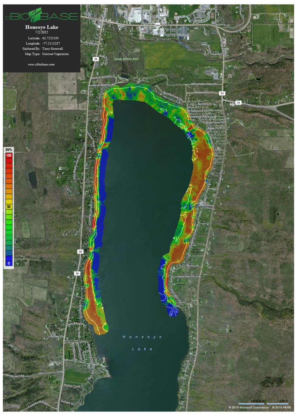
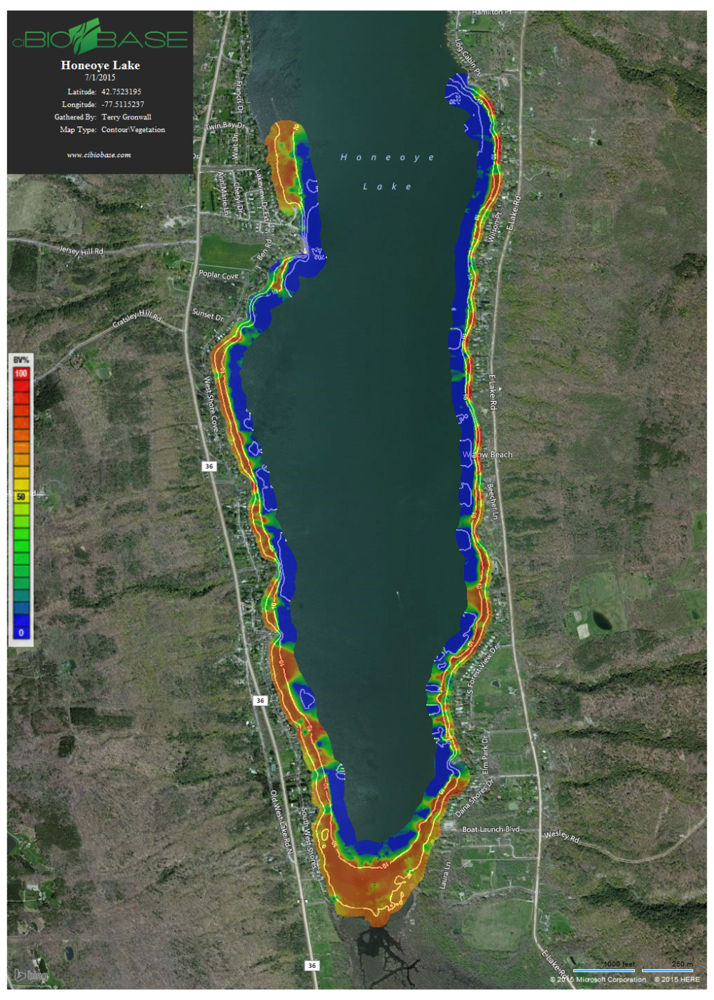
Below are Aquatic Macrophyte/Vegetation maps of Honeoye Lake
Below are the 2015 Vegetation Maps of Honeoye
The color key to read the maps are:
Red ~90-100%
Yellow/Orange ~50-90%
Green ~15-50%
Blue ~ 0-15%
Below are the sonar weed maps of Honeoye Lake from 8/22/2015 AND 7/29/2105: