-
-
-
-
-
-
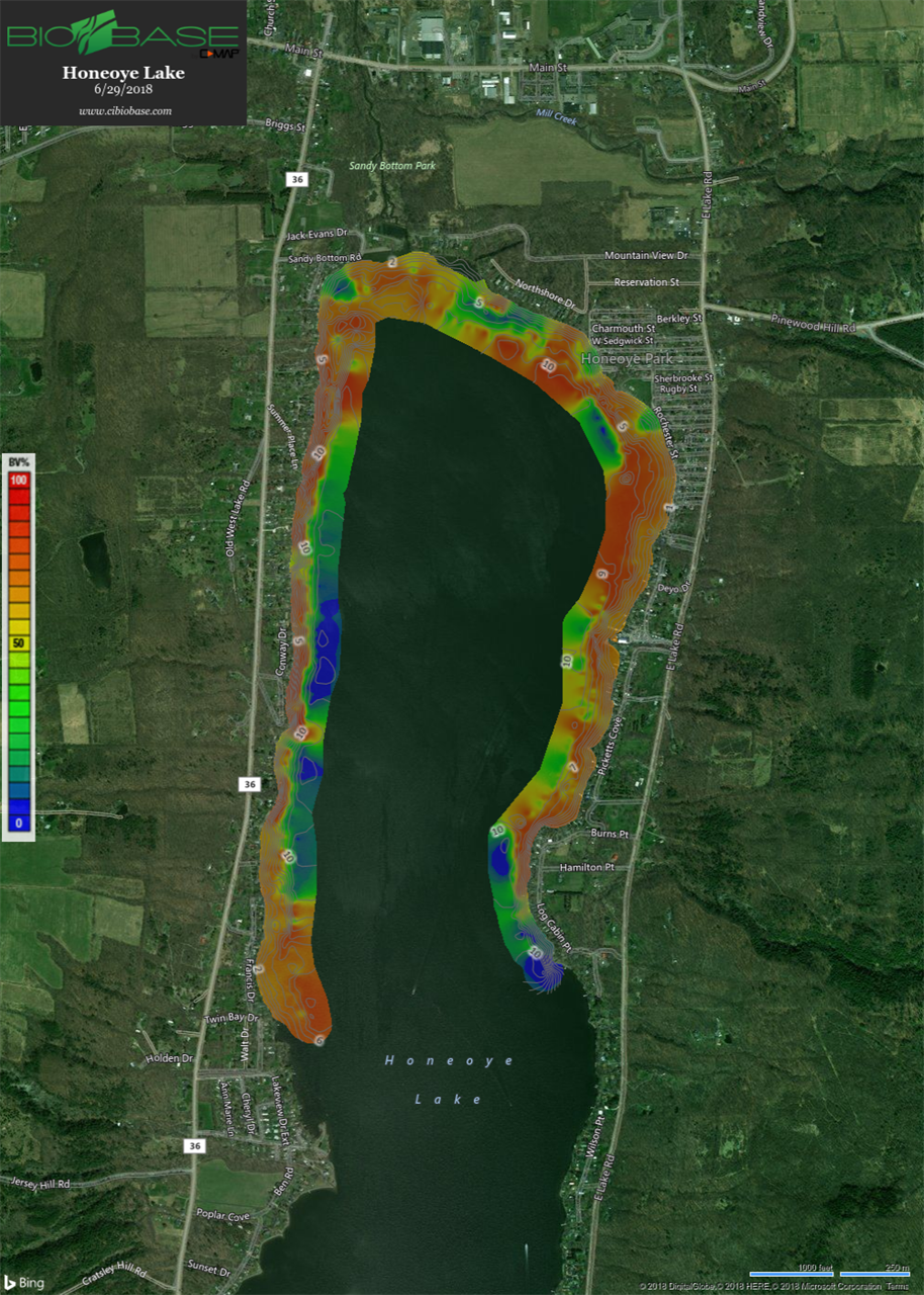
2018 Weed Mapping
-
-
-
-
-
2018 Weed Mapping
June 2018
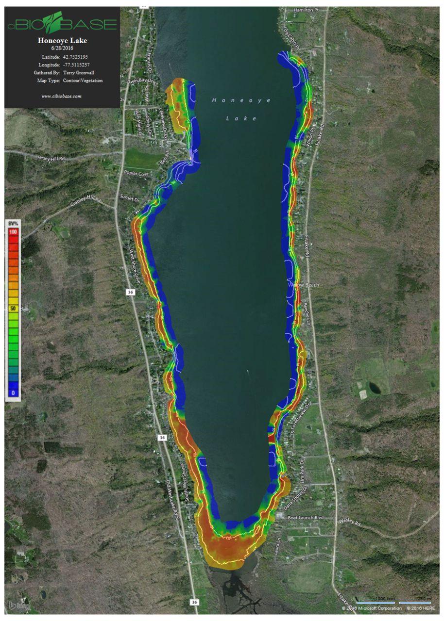
There are white contour depth lines every 5' on the maps. Most of the
red areas on the map are between 5-10' of water depth. The weed line (dark
green to blue transition) still appears to be at ~12' of water depth.
Our macrophyte visual observations are:
1. The macrophytes are unusually high in the water column for this early in
the season. There are places like SW Shores, Lakes End Lane, Dana Drive,
Pickett's Cove, Cottage Cove, Deyo Drive, Honeoye Lake Park, Twin Bay, and
Francis Shores where the macrophytes are to the surface and so heavy we
can't easily get our boat into these areas. This probably due to the mild
winter and early ice out this year.
2. There are large floating matts of macrophytes in the red areas of the
lake.